Back around 2014 I had a solo fastpack planned in the Sierra Nevada, and the Sierra was on fire. So I pivoted east instead, across Nevada, to a range a lot of people have never heard of: the Ruby Mountains. I fastpacked the Ruby Crest Trail on my own, and it was an amazing trip, one I still think about.
I went to college in Reno and I’ve always had a soft spot for the Great Basin, and the Rubies are a big part of why. So I built the heart of it in forge3d, on the best lidar I could find: a flight up Lamoille Canyon, the way the trail climbs out of it, to Liberty Lake on a clear August evening.
Lamoille Canyon to Liberty Lake, 1 August, 6:15 pm · USGS 3DEP lidar, 1 m in the canyon · NAIP 2022 aerial photography · rendered with forge3d 1.42
returns
mouth to Lamoille Lake
measured in the lidar
for the render
An island in the sky
The Ruby Mountains run about 80 miles north to south through Elko County in northeastern Nevada, and they’re only about 11 miles wide. Like most Great Basin ranges they stand up out of a sea of sagebrush, but up top there’s real alpine country: glacial lakes, cirques and peaks over 11,000 feet. The high point is Ruby Dome, which comes out at about 11,390 feet in the lidar. The Western Shoshone name for the range is often given as Duka Doya, “snowcapped.” On the west side, a group of canyons above the lands of the Te-Moak Tribe of Western Shoshone forms the headwaters of the South Fork of the Humboldt River.
The English name comes with a good story. A historical marker near Lamoille, put up by E Clampus Vitus in 2005, says that in 1854 an Army survey party looking for a route west stopped for a noon halt somewhere in the range. A man named Davis panned for gold and found “rubies” instead. They were red garnets, and the name stuck anyway. The garnets are real, and they turn out to be a clue to how strange these rocks are.
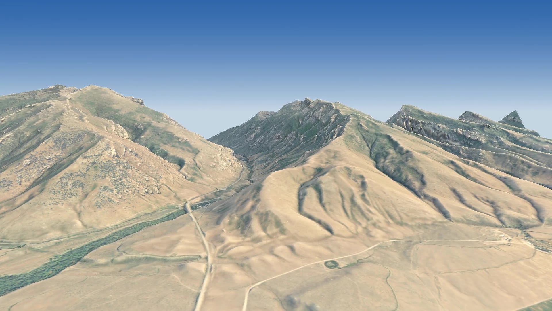
The opening: the front of the Rubies from over the Lamoille valley, with the canyon road winding toward the mouth. Click any image to enlarge.
The Ruby Crest Trail
The Ruby Crest National Recreation Trail runs along the spine of the range from Harrison Pass in the south to Roads End, at about 8,800 feet near the top of Lamoille Canyon. It was certified as a National Recreation Trail in 1979. How long is it? That depends on who’s counting and where you start, and you’ll see anything from about 36 to 43 miles. It stays high for long stretches, and one long day in the middle has no water at all.
Heading north, the trail passes a chain of glacial lakes: Overland Lake, North Furlong, Favre and Castle, then Liberty Lake. It climbs over Liberty Pass and drops past Lamoille Lake and the Dollar Lakes to Roads End. That last stretch, the beautiful one, is what this flight covers, only backwards: it starts at the bottom of the canyon and climbs to Liberty Lake.
The canyon the ice built
Lamoille Canyon gets called the “Yosemite of Nevada,” and from the air you can see why. It’s a classic glacial trough. The cross-section is a broad U, not the V a river would carve, with steep walls and a flat floor. In the lidar, the canyon floor runs 17.6 km (about 11 miles) from the mouth to Lamoille Lake and climbs about 1,020 m (3,356 feet) on the way. Halfway up, the walls stand about 950 m (over 3,100 feet) above the floor.
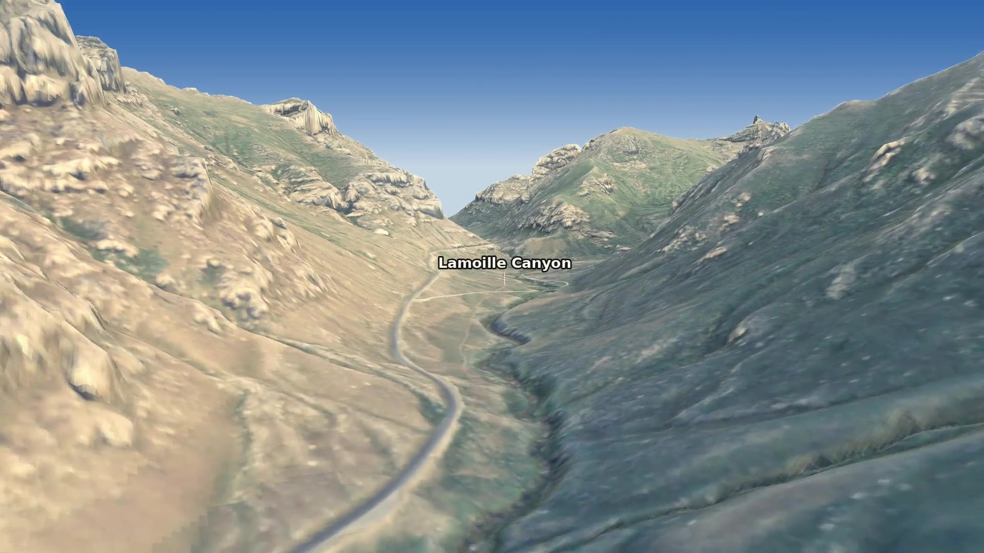
Up the trough: the road and Lamoille Creek on the flat floor, the sun on the north-east wall.
Side canyons hang high on the walls. Their own smaller glaciers fed into the big one, and when the ice melted they were left perched above the main floor. Island Lake sits in one of those cirques. The Nevada Bureau of Mines and Geology describes its little glacier as hanging down to join the one in Lamoille Canyon. Up at the head, cirques hold Lamoille Lake and the Dollar Lakes, and Liberty Lake sits in its own bowl just over the pass.
Geologists have long recognized two big ice advances here, both named for local places. The older one is the Lamoille glaciation, and the younger is the Angel Lake glaciation, named for a lake in the East Humboldt Range to the north-east. In 1984 William Wayne compared how weathered their boulders and soils are. He found the older deposits had been exposed for as much as ten times longer, and he placed only the Angel Lake advance in the last ice age. More recently, exposure dating of moraine boulders near Lamoille has put the younger moraines at roughly 15,000 to 30,000 years old. That’s the same time the glaciers were filling Lee Vining Canyon in the Mono Basin.
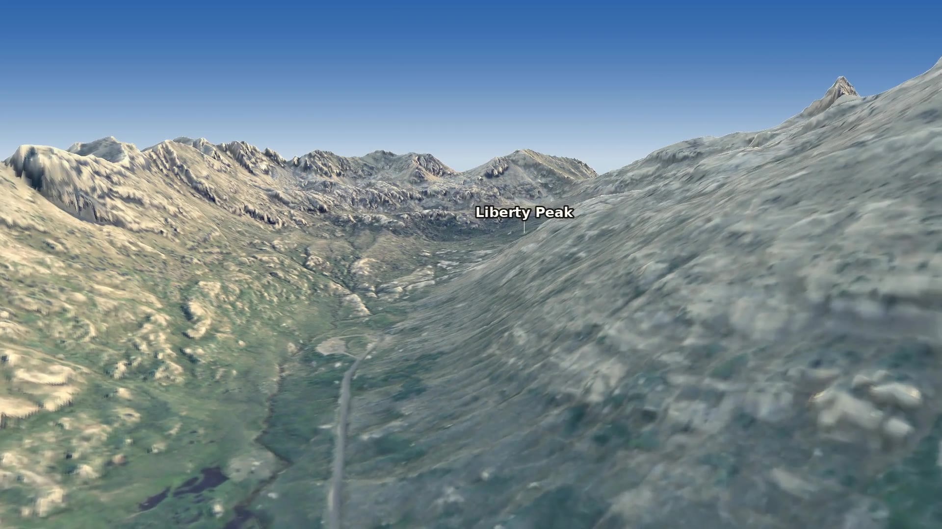
Further up, where the canyon bends south toward its headwall.
Rocks from 35 kilometres down
Here’s the wild part. Most of the rock you walk on along the crest didn’t form anywhere near the surface. The Rubies, together with the East Humboldt Range, are a metamorphic core complex: a piece of the deep crust that was cooked, squeezed and then pulled back up to daylight.
- Buried. It started as ordinary seafloor sediment, Cambrian and Ordovician limestone, dolomite and shale, roughly 540 to 443 million years old. Mountain building buried those layers at least 35 km deep, where they were heated and folded like taffy into gneiss and marble.
- Invaded. Granite and pegmatite pushed into them over a long stretch of time, in pulses from the Jurassic through the Oligocene. The red garnets that named the range grew in these hot, deep rocks.
- Stretched. When the region began pulling apart, the deep rocks rose along a great shear zone on the west side of the range, about a kilometre thick, where the rock was smeared out while still hot. A low-angle detachment fault above it carried the cover rocks away. It cuts basalt dikes about 17 million years old, so it was still moving in the middle Miocene.
- Still moving. Younger faults along the range front have offset glacial outwash, so the uplift didn’t stop with the ice.
As a geocacher I love that there’s an EarthCache about all this: the Nevada Bureau of Mines and Geology’s “Nice” (gneiss) Rocks, at Island Lake, a 2-mile walk from the Lamoille Canyon road. The folds in the gneiss there are the deep crust showing its stretch marks.
Lakes at the top
The flight slows down past Roads End and climbs the headwall to Lamoille Lake, at about 9,740 feet. Then it crosses Liberty Pass. The lidar puts the lowest point of the pass at 10,410 feet, right on the 10,400 the trail guides give. On the far side is Liberty Lake, sitting in its rocky bowl under Liberty Peak, at the head of Kleckner Canyon. If you hike the trail north to south, this is where the Rubies first really show off. If you’re going the other way, like the flight, it’s the reward at the top of the climb.
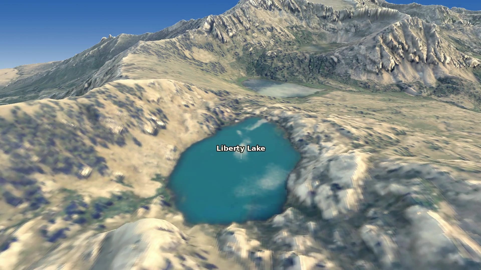
Over Liberty Pass, with Liberty Lake below and the crest running on to the south.
Who lives up there
The Rubies have their own odd zoo. The strangest residents are Himalayan snowcocks, big grouse-like birds from the mountains of Central Asia. Starting in the 1960s, Nevada released more than 2,000 of them, the first wild-trapped in Pakistan, and they took. The Rubies and the neighboring East Humboldt Range are the only places in North America where they live in the wild, high on the cliffs above treeline.
Mountain goats work the same cliffs, and bighorn sheep, mule deer, marmots and pikas are all up there too. Down on the canyon floor, beaver have shaped the meadows along Lamoille Creek. Most of the high country, about 90,000 acres, has been protected as the Ruby Mountains Wilderness since 1989.
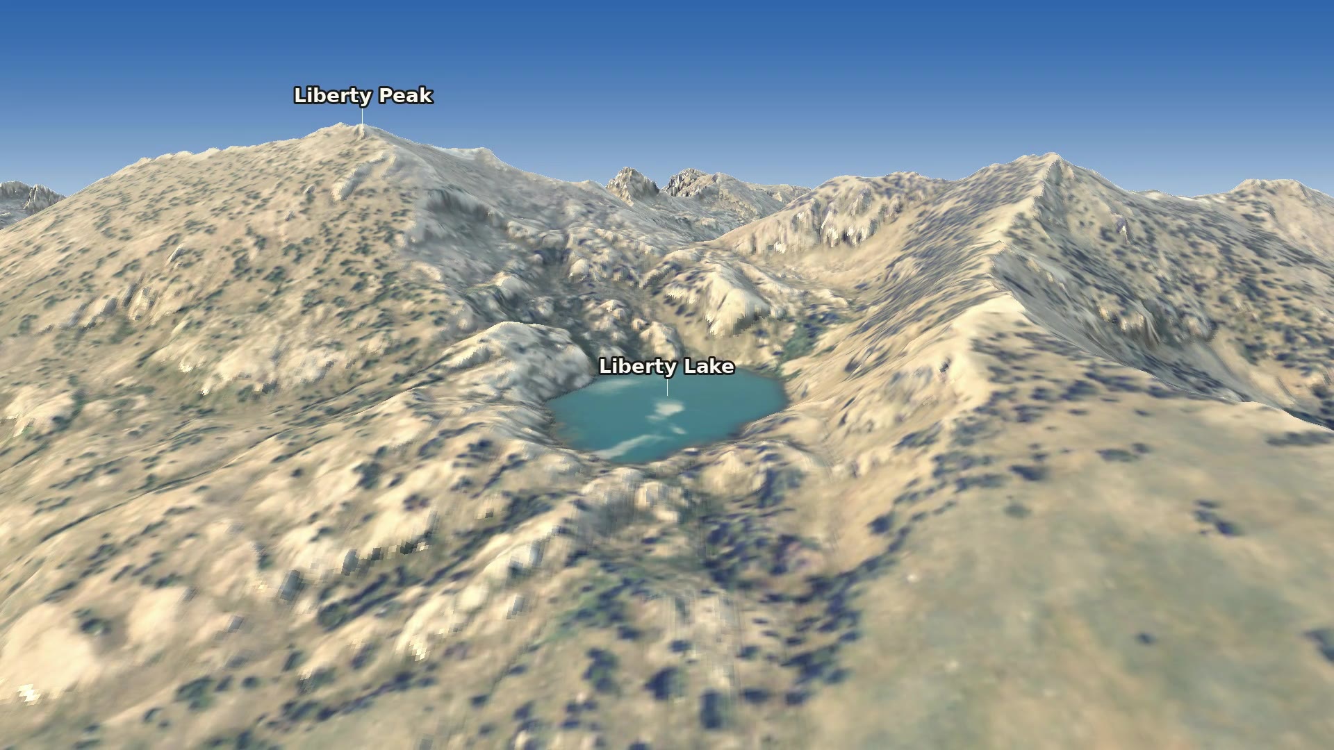
The last frame: back across Liberty Lake to Liberty Peak and the pass.
How it’s made
The terrain is USGS 3DEP lidar. Almost all of it comes from the 2021 survey of east-central Nevada, which covers nearly every point on the flight with about 4 to 7 ground returns per square metre. A 2016 survey of the upper Humboldt fills a strip of valley floor near the canyon mouth. The two meet within 15 cm. Eight of GitHub’s free computers pulled the ground returns out of the point-cloud archive in 2 km tiles, about 1.7 billion of them. The canyon itself is gridded at 1 m, and the ridges around it at 4 m. The color is USDA NAIP aerial photography from 2022, lightly shaded by the 1 m lidar so the moraines and talus read. The lakes are flattened at their shorelines, right where the lidar finds them, within about 50 m of Lamoille Lake’s published spot and 180 m of Liberty Lake’s.
The camera follows the canyon too. A little script finds the cheapest route from the canyon mouth to Lamoille Lake in the lidar, where every metre of climbing is expensive, and that turns out to be the canyon floor. The flight is just a few keyframes placed along it. Place names fade in only when you can actually see them, not hidden behind a ridge or lying edge-on to the camera.
One honest limit: forge3d’s viewer draws the terrain as a 2,048 × 2,048 mesh however fine the data is. Over a block this size, that’s a vertex every 8 to 11 m, so the closest walls show some facets. It was all rendered with no graphics card, split into 40 pieces on GitHub’s free computers, using Mesa’s software Vulkan. The code is on GitHub, and if you have a favorite corner of the Rubies, the keyframes are easy to edit.
Sources: National Recreation Trails: Ruby Crest Trail · Travel Nevada: Ruby Crest Trail · USDA Forest Service: glacial activity, Lamoille Canyon · Naming of the Ruby Mountains historical marker · NBMG EarthCache: “Nice” (gneiss) Rocks at Island Lake · Zuza, Dee & Henry (2025), NBMG Open-File Report 2025-08 · Wayne (1984) · Wesnousky et al. (2016) · Wikipedia: Ruby Mountains · Himalayan snowcock · Lamoille Lake · Liberty Lake · USGS 3DEP.
Go deeper
Ep. 20: Update – Hiking the Ruby Crest Trail — Trails Worth Hiking, 1 November 2021, about 61 min. Jeremy Pendrey finally finishes the trail with his son and a friend, after snow and wildfires turned him back in 2018. That’ll sound familiar.
Hiking Lamoille Canyon: Aspen Forests, Streams, and Beaver Dams — Outdoor Nevada, 15 September 2021, about 7 min video. A quick walk through “Nevada’s Yosemite,” snowcocks included.
Episode 114: Elko to Lamoille — Wild Nevada (PBS Reno), 22 May 2020, about 27 min video. South Fork, Ruby Lake refuge and a morning in Lamoille Canyon.
Episode 704: The Lesser Known Rubies — Wild Nevada (PBS Reno), 9 January 2025, about 27 min video. Soldier Creek, Robison Lake, the Ruby Marshes, Harrison Pass and Angel Lake.
Brian Wernicke on Lithospheric Extension and the Basin and Range — Geology Bites. How the Great Basin got stretched, and how detachment faults bring deep rock up to the surface.
Episode 41: Soft as a Rock: Tectonic Stretching of the Earth’s Crust — Arizona Public Media. University of Arizona geologist George Davis on deep crust that gets stretched and hauled up to the surface.
Zuza, A.V., Dee, S. & Henry, C.D. (2025). Geologic map of the Ruby Mountains–East Humboldt Range–Wood Hills–Pequop Mountains metamorphic core complex region, Elko County, Nevada. Nevada Bureau of Mines and Geology Open-File Report 2025-08, 1:62,500.
Snoke, A.W. & Howard, K.A. (1984). Geology of the Ruby Mountains–East Humboldt Range, Nevada: a Cordilleran metamorphic core complex. Mackay School of Mines, Reno, pp. 260–303.
Wayne, W.J. (1984). Glacial chronology of the Ruby Mountains–East Humboldt Range, Nevada. Quaternary Research 21(3), 286–303.
Wesnousky, S.G., Briggs, R.W., Caffee, M.W., Ryerson, R.J., Finkel, R.C. & Owen, L.A. (2016). Terrestrial cosmogenic surface exposure dating of glacial and associated landforms in the Ruby Mountains–East Humboldt Range of central Nevada and along the northeastern flank of the Sierra Nevada. Geomorphology 268, 72–81.
Stiver, S.J. (1984). The Himalayan snowcock – Nevada’s newest upland game. Cal-Neva Wildlife Transactions 26, 55–58.
Humboldt-Toiyabe National Forest: hiking — trail conditions and the Ruby Mountains Ranger District. · NBMG EarthCache at Island Lake — the deep crust, a 2-mile walk from the road.
USGS 3D Elevation Program (3DEP) — the lidar under every frame. · USGS Lidar Explorer — see what’s been flown near you. · forge3d — the Python terrain renderer. · ruby-flyover — this project’s code.