Highway 120 runs right past where I grew up in Groveland. Follow it east long enough and it climbs through Yosemite, tops out at Tioga Pass, and then does one of the great things a road can do: it falls off the edge of the Sierra Nevada. In about twelve miles it drops roughly 3,000 feet down Lee Vining Canyon, and the whole Mono Basin opens up below you. There's a huge, strange, blue lake with two volcanic islands in it, white towers along its shore, and a line of young volcanoes marching off to the south.
I’ve wanted to fly that drop for a long time. So I built it in forge3d, on the best elevation data I could get my hands on, and tried to make it feel like you’re really there on a clear September morning.
Tioga Pass to the Mono Craters, 26 September, 8:45 am · USGS 3DEP 1 m lidar · NAIP 2022 aerial photography · rendered with forge3d 1.40.1
the camera
to the lake
Crater erupted
for the render
Tioga Pass: the top of the road
The flight starts over Tioga Pass, 9,945 feet up and Yosemite’s east gate. The road over it began as the Great Sierra Wagon Road. It was built in 1883 to reach silver mines near Bennettville, in about 130 days, mostly by Chinese laborers. Stephen Mather bought the old road in 1915 and gave it to the park, and the modern Tioga Road opened in 1961. It still closes every winter. Snow buries it most years from November into late spring, and the plows can take a month or two to dig it out.
The pass is also where the weather changes. Pacific storms drop most of their moisture on the west side of the range. On the crest that adds up to something like 40 to 50 inches of precipitation a year, while out on Mono Lake it’s only about 8. You can see the rain shadow in the colours as the flight goes east: green forest and meadow give way to sagebrush and pale volcanic ground.
Mount Dana and the canyon the ice carved
On the right as the flight heads east is Mount Dana, 13,061 feet, the second-highest peak in Yosemite. Its rusty, dark rock isn’t the pale granite you might expect. It’s part of an old roof pendant, a slab of much older volcanic and sedimentary rock, around 220 million years old, that the granite pushed up underneath and never quite swallowed.
Then the ground falls away into Lee Vining Canyon. It’s a classic glacial trough. During the last ice ages, glaciers filled it and spilled out into the basin, the most recent one around 20,000 years ago. They left big lateral moraines along the canyon mouth, long ridges of rubble that the flight passes over on its way out. The camera stays below the rims for this stretch, and this is where the lidar really shows off: you can see every talus slope and rock rib on the canyon walls.
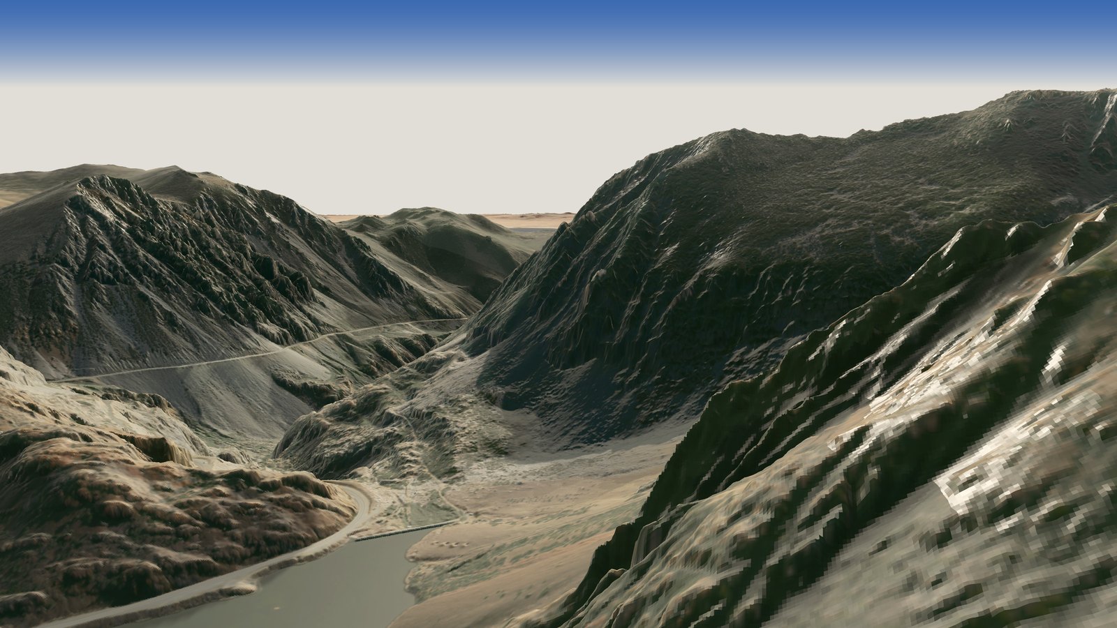
The head of Lee Vining Canyon, with Ellery Lake below. Click any image to enlarge, and click again for full 4K detail.
Mono Lake: old, salty and stubborn
Mono Lake is at least 760,000 years old, one of the oldest lakes in North America. It’s what’s left of a much bigger Ice Age lake, Lake Russell, whose old shorelines you can still trace high on the hills. Nothing flows out of it, so everything the creeks carry in stays behind when the water evaporates. Today it’s more than twice as salty as the ocean and very alkaline, with a pH around 10.
In 1941 Los Angeles began diverting the creeks that feed it, including Lee Vining and Rush creeks, the same Lee Vining Creek the flight follows down the canyon. Without that inflow the lake fell about 45 feet, from 6,417 feet in 1941 to a low of 6,372 in 1982. It lost about half its volume, and its saltiness doubled. A small group of scientists and students formed the Mono Lake Committee in 1978. In 1983 the California Supreme Court ruled in National Audubon Society v. Superior Court that the state has to weigh the public trust, the lake itself, against water rights. In 1994 the State Water Board set a target level of 6,392 feet. The lake has climbed back part of the way, but at about 6,382 feet this fall it’s still around ten feet short, and this year the State Water Board has been taking a fresh look at how the lake is doing and what might help.
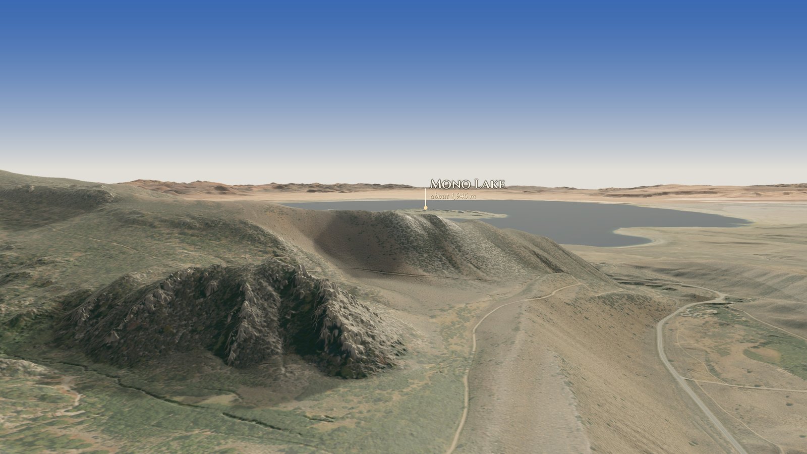
Out of the canyon mouth, with Mono Lake ahead.
Two islands, two kinds of volcano
Out on the lake the flight passes two islands that couldn’t look more different. Negit, the dark one, is a volcanic dome and lava flows less than about 2,000 years old. Paoha, the big pale one, is mostly old lake-bottom mud. Sometime in the last 300 years, between about 1720 and 1850, magma pushed up beneath it and lifted the lakebed right out of the water. That makes it one of the youngest landforms in the whole basin.
Negit has a story too. As the lake dropped, a land bridge appeared to it in the late 1970s. Coyotes walked across to the California gull colony, and in 1979 not a single gull chick survived. Mono Lake hosts tens of thousands of nesting gulls in a typical year, around a quarter of the species’ world population. The colony has had some hard recent years, which is one more reason the lake level matters.
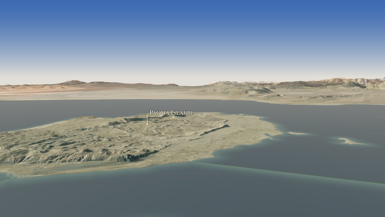
Paoha Island, the pale one: lake-bottom mud lifted out of the water within the last 300 years.
Brine shrimp, flies and a lot of birds
No fish can live in water this salty. What does live here, in enormous numbers, is the Mono brine shrimp, Artemia monica, found nowhere else in the world. In summer there are trillions of them. Along the shore live alkali flies, which crawl underwater inside a bubble of air and pop back up perfectly dry. Mark Twain watched them in the 1860s and wrote in Roughing It that they “pop up to the surface as dry as a patent office report.”
The fly pupae were an important food for the Mono Lake Kootzaduka’a, whose name comes from kootzabe, the pupae, and means something like “fly-pupae eaters.” Birds feast on them too. Over a million eared grebes stop here each fall, along with tens of thousands of phalaropes. For a lake Twain called the “loneliest spot on earth,” it’s a busy place.
South Tufa: towers made by springs
The flight drops low over the water toward South Tufa. The white towers along the shore are tufa, a kind of limestone. They form underwater where calcium-rich spring water bubbles up into the carbonate-rich lake, and the two react around each spring like a slow chemistry experiment. The towers can take decades to centuries to grow. You can walk among them today because the lake dropped and left them standing on dry land. The Mono Lake Tufa State Natural Reserve has protected them since 1981.
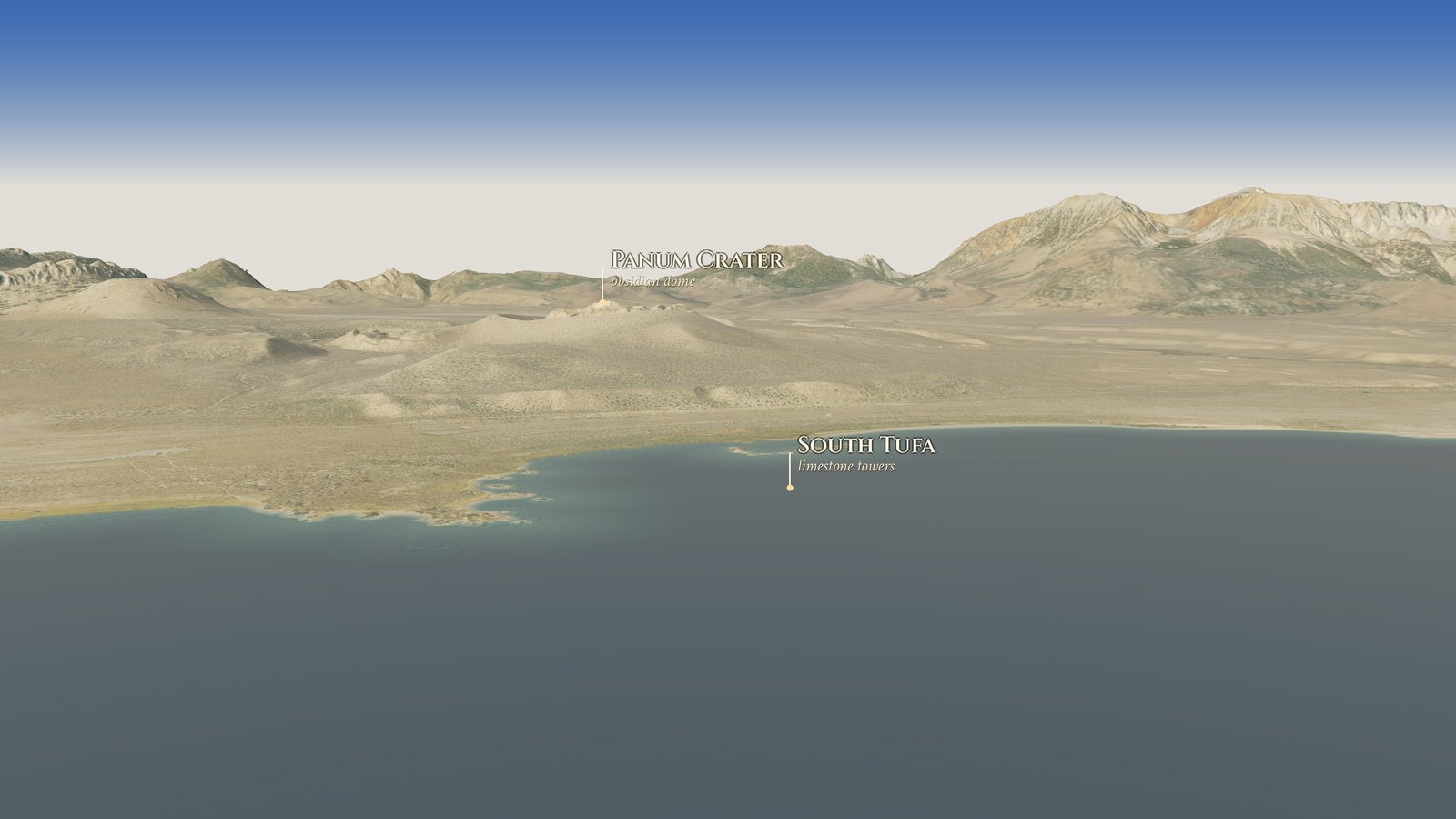
Low over the water toward South Tufa, with Panum Crater beyond.
Panum Crater and the Mono Craters
Just south of the shore is Panum Crater, the northernmost of the Mono Craters. It erupted around 1350 CE, a blink in geologic time. It started with a steam blast, then threw out a ring of pumice, and then a dome of sticky lava, full of black obsidian, pushed up in the middle. Paiute people used that obsidian for tools and traded it across the mountains.
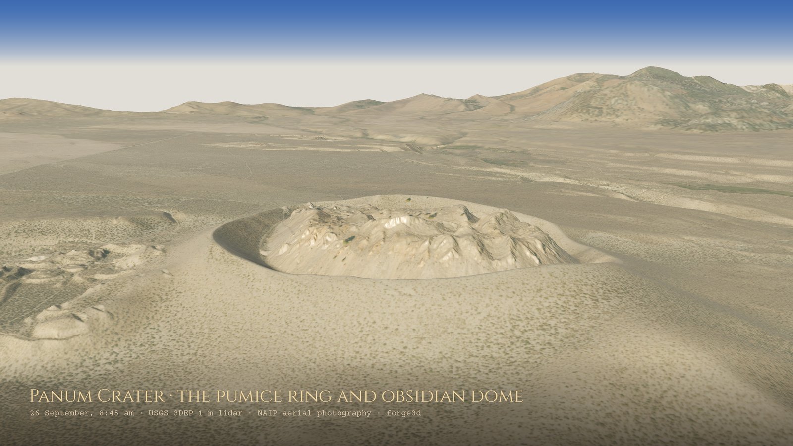
Panum Crater up close: the ring of pumice from the explosive start, and the rough obsidian dome that squeezed up inside it, about 670 years ago. Click any image to enlarge it, then click again to see it at full 4K size and scroll around.
The Mono Craters run about 17 km south from there: some 30 domes, flows and craters, almost all rhyolite. The highest point is 9,173 feet. These are some of the youngest volcanoes in California, and USGS rates the Mono–Inyo chain as a high-threat volcanic system. Just to the south is the Long Valley Caldera, left by a gigantic eruption about 760,000 years ago. In the flight you can see the domes as lumpy, flat-topped mounds, with the morning sun casting their shadows west.
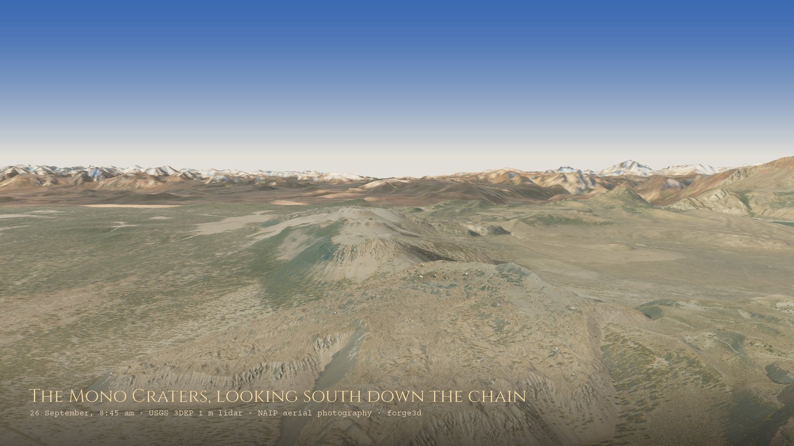
Looking south down the Mono Craters: flat-topped domes of rhyolite with steep, blocky flanks, one after another.
Looking back
The flight ends east of the craters, turning to look back the way it came: the domes in front, and behind them the whole eastern escarpment of the Sierra Nevada, with Mount Dana and Mount Gibbs on the skyline. That wall is a fault scarp. The Sierra is a giant block of crust tilted up along faults on its east side, while the basin dropped. The same stretching of the crust that raised the mountains also made the room for the magma that built the craters and islands. It’s one connected story, told in rock, water and fire, and you can fly the whole thing in about two minutes.
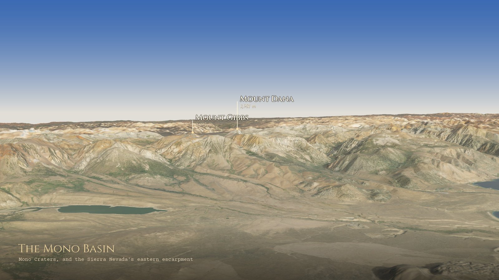
The last frame: looking back west at the escarpment, with Mount Dana and Mount Gibbs on the skyline.
How it’s made
The terrain is USGS 3DEP lidar. Two surveys cover the whole route at 1 m. The Sierra Nevada survey was flown in 2021 and 2022, and the Yosemite survey in 2019. Both are Quality Level 1, the USGS standard calling for at least eight laser points per square metre. The colour is USDA NAIP aerial photography from 2022, at 0.6 m near the camera. The far skyline uses Sentinel-2 satellite images from September and early October 2025.
The tricky part is that forge3d’s viewer draws at most about 2,048 points across a terrain. Over a region 36 km wide, that’s one point every 18 m, and most of the lidar gets thrown away. So, as in my SOLSTICE flight over Chaco Canyon, every frame is drawn in four layers and stacked:
- a 170 km horizon
- the whole region
- a few kilometres around what the camera sees, at 2 to 3 m
- the ground right under it, at 1 to 1.5 m
The windows move with the flight. The work is split into 60 pieces that render side by side on GitHub’s free computers, with no graphics card. One more trick: the aerial photos show Mono Lake pea-green with summer algae and sun glare, so the lake is recoloured from the lidar itself, using the flat surface at about 1,946 m.
The code is on GitHub. The flight path is a short list of keyframes you can edit, so if you have a favourite spot in the Mono Basin, you can fly to it.
Sources: Mono Lake Committee: State of the Lake · State Water Board: Mono Lake background · National Audubon Society v. Superior Court (1983) · USGS: Mono–Inyo Craters · USGS field guide: Mono Lake · USGS field guide: Panum Crater · Smithsonian GVP: Mono Lake Volcanic Field · Mono Lake Committee: tufa · brine shrimp · alkali flies · Kootzaduka’a · NPS: Tioga Road · Mark Twain, Roughing It, ch. 38 · USGS 3DEP. Contains modified Copernicus Sentinel-2 data (ESA).
Go deeper
Blue Dot 215: California’s Weird, Wonderful Sea: Mono Lake — Blue Dot (North State Public Radio), 14 May 2021, about 53 min. Dave Schlom with Nora Livingston and Geoff McQuilkin of the Mono Lake Committee on brine shrimp, alkali flies, gulls and tufa.
Blue Dot: ECOSTRESS and Mono Lake — Blue Dot (North State Public Radio), 2 September 2022, about 52 min. The second half catches up on falling lake levels and dust with Kurtis Alexander and the Mono Lake Committee.
Blue Dot 60: Exploring the Long Valley Caldera with Dave Hill & Margaret Mangan — Blue Dot (North State Public Radio), 22 June 2017, about 29 min. Two USGS volcano folks on the 1980 unrest under Mammoth Lakes.
Evolution of Eruption – Intro to the Long Valley Caldera — PlanetGeo: The Geology Podcast, 8 May 2025, about 29 min. Chris and Jesse with USGS geologist Andy Calvert on the Bishop Tuff supereruption.
What Are These Strange Towers Growing Out of This Lake? — Untold Earth (PBS Nature), 24 August 2023, about 9 min video. A lovely short on tufa, phalaropes and the people who saved the lake.
Sieh, K. & Bursik, M. (1986). Most recent eruption of the Mono Craters, eastern central California. Journal of Geophysical Research 91(B12), 12539–12571.
Bursik, M. & Sieh, K. (1989). Range front faulting and volcanism in the Mono Basin, eastern California. Journal of Geophysical Research 94(B11), 15587–15609.
Jellison, R., Miller, L.G., Melack, J.M. & Dana, G.L. (1993). Meromixis in hypersaline Mono Lake, California. 2. Nitrogen fluxes. Limnology and Oceanography 38(5), 1020–1039.
Stine, S. (1994). Extreme and persistent drought in California and Patagonia during mediaeval time. Nature 369, 546–549.
Hildreth, W. (2004). Volcanological perspectives on Long Valley, Mammoth Mountain, and Mono Craters: several contiguous but discrete systems. Journal of Volcanology and Geothermal Research 136, 169–198.
The Mono Basin Ecosystem: Effects of Changing Lake Level — National Research Council, 1987; the science that helped tip the lake’s fate, free to read online.
Roughing It — Mark Twain, 1872; chapter 38 is his gloriously grumpy visit to Mono Lake.
Mono Lake Committee — lake levels, history and the folks who’ve looked after it since 1978. · Mono Lake Kootzaduka’a Tribe — the Tribe’s own home on the web. · State Water Board: Mono Lake — D-1631 and the 6,392-foot target.
Mono Basin Scenic Area Visitor Center — Inyo National Forest. · Mono Lake Tufa State Natural Reserve — California State Parks.
USGS California Volcano Observatory — with pages for the Mono–Inyo Craters and Long Valley Caldera.
USGS 3D Elevation Program (3DEP) — the lidar under every frame. · The National Map Downloader — grab the tiles yourself. · forge3d — the Python terrain renderer. · mono-flyover — this project’s code.