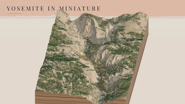
First it was a little tabletop Seattle, then Yosemite Valley. Both are home ground for me. For the next one I wanted a place I love, and the Amalfi Coast was the easy pick. I’ve been there, and I can’t wait to go back: swimming in that impossibly clear water, a spritz in the afternoon, and a cold limoncello beer. Ravello, up on its ridge above the sea, and the island of Capri are my two favorite places on it.
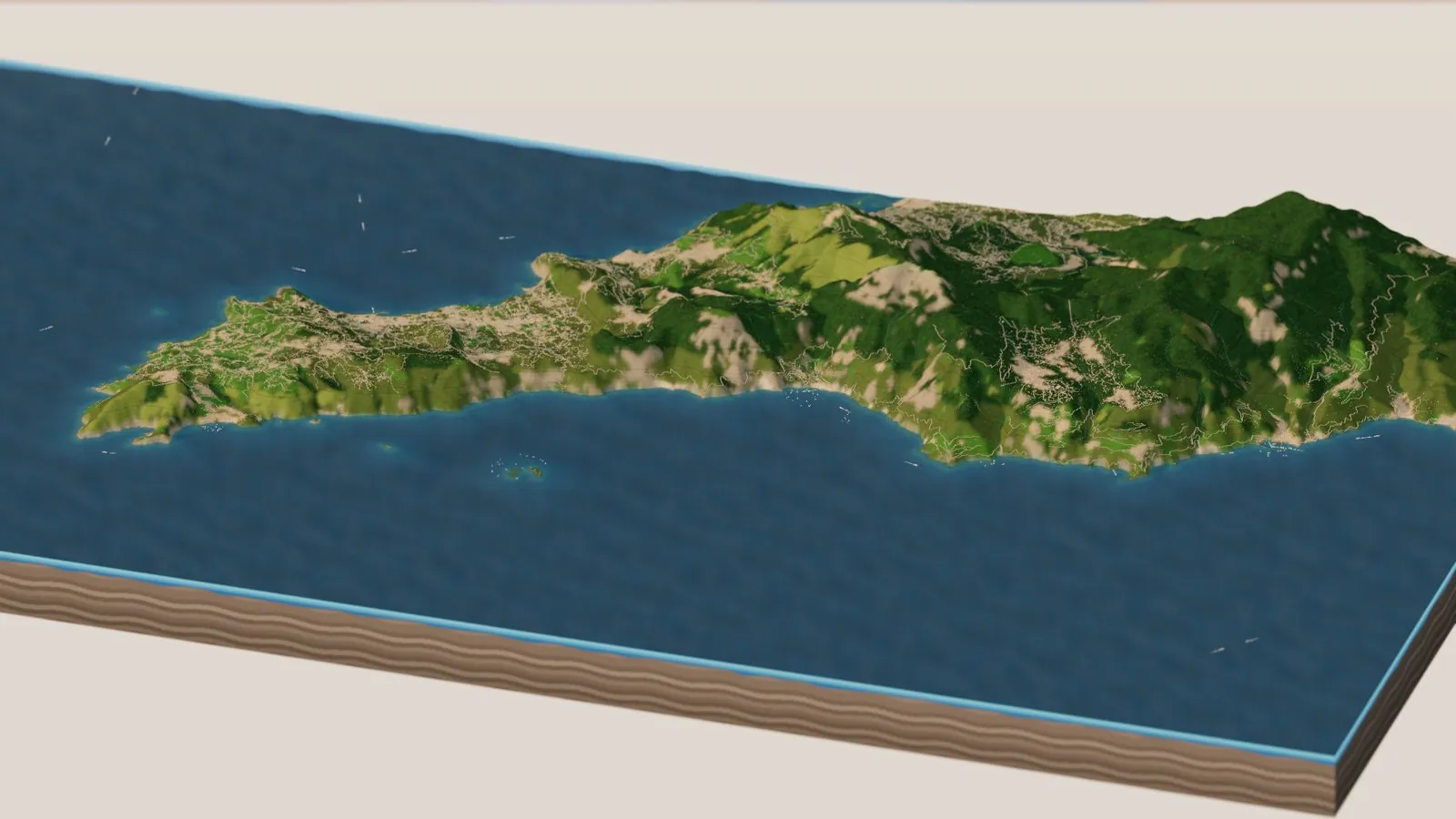
I even get to ride the coast road from home. It’s one of my routes on the Garmin bike trainer, so I’ve pedaled every hairpin from Positano to Amalfi in my living room. Now I can fly over it too. Here is the whole Amalfi Coast, in miniature.
It runs from Capri and the tip of the Sorrento peninsula in the west, past Positano, Praiano, Furore, Amalfi and Atrani, to Ravello and Minori in the east. The cliffs come out of real elevation data, the sea sparkles, ferries cross to Capri, boats sit at anchor off the little beaches, and you can ride along the coast road itself. It runs in the browser. Spin it, tilt it from high above down to sea level, and watch the towns light up at night.
The Amalfi Coast, morning to night, in high summer · Terrain Tiles on AWS (SRTM / EU-DEM) · OpenStreetMap · rendered in Three.js on GitHub’s free computers
you can ride
and sailboats
in high summer
OpenStreetMap
Try it first
Drag to spin it, scroll to zoom, and tilt it from a map view right down to the water. Fly to takes you to Capri and the Faraglioni, Positano, the Path of the Gods, the Fiordo di Furore, Amalfi and Atrani, Ravello, or the little Li Galli islands. Under Ride along, Drive the Amalfi Coast road puts you behind a car leaving Positano, and Ferry to Capri follows a boat across the water. The High summer switch puts out the beach umbrellas and fills the bays with boats; switch it off for a quiet October, with the chestnut woods turning gold up on the mountains. There’s a Rain button too, for a Mediterranean squall.
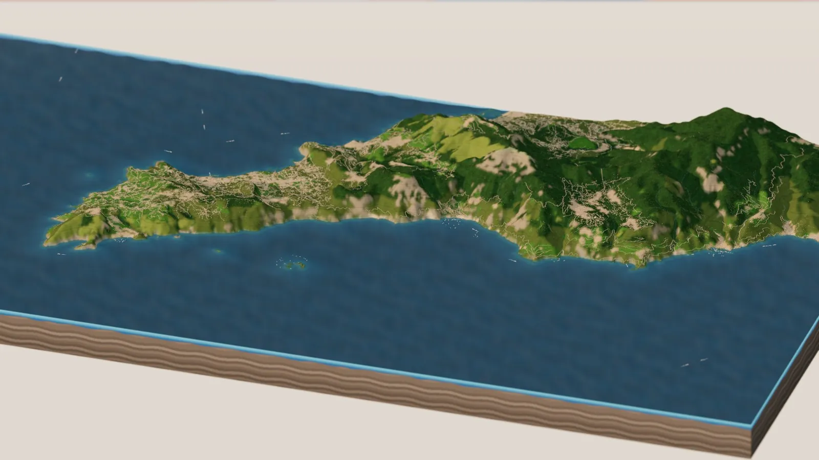
Loads the live 3D coast right in this page (about 15 MB of data, so give it a moment) · or open it full screen
Mountains that fall into the sea
What strikes you first about the Amalfi Coast is how little flat ground there is. The Lattari Mountains rise straight out of the sea to more than 4,700 feet, and the towns cling to the gaps where a steep valley meets the water. In the diorama the sea is see-through, so you can watch the land keep falling away under the water: pale sand in the shallows, then turquoise, then deep blue.
The whole coast, with Capri off the tip of the Sorrento peninsula and the Lattari Mountains running east.
The road above the sea
The coast road, the SS163 Amalfitana, might be the most famous drive in Italy. It’s a narrow ribbon cut into the cliffs, all hairpins and sudden views, with the sea a long way down on one side and the mountain on the other. Hop in with Drive the Amalfi Coast road and you set off east from Positano, past Praiano and the gorge at Furore, around the headlands to Amalfi and on toward Minori. In the diorama it’s about 37 kilometers of road, pulled straight from OpenStreetMap and stitched into one line.
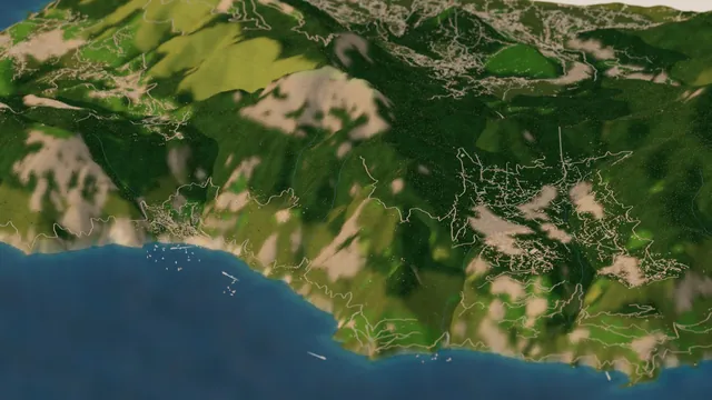
Positano to Furore from the sea, with the coast road along the cliffs and the high road up to Agerola above.
Positano, and the boats
Positano tumbles down its hillside to the beach in a stack of pastel houses. John Steinbeck wrote about it for Harper’s Bazaar in 1953, and his line has been on postcards ever since: “Positano bites deep. It is a dream place that isn’t quite real when you are there and becomes beckoningly real after you have gone.”
In the diorama the beach is lined with orange umbrellas in high summer, and the bay is full of boats: yachts and sailboats rocking at anchor, and ferries coming and going from the pier with white wakes behind them. They run the real ferry lines from OpenStreetMap, and stop at the ports before heading back out. Switch the season off and most of the boats and every one of the umbrellas go away.
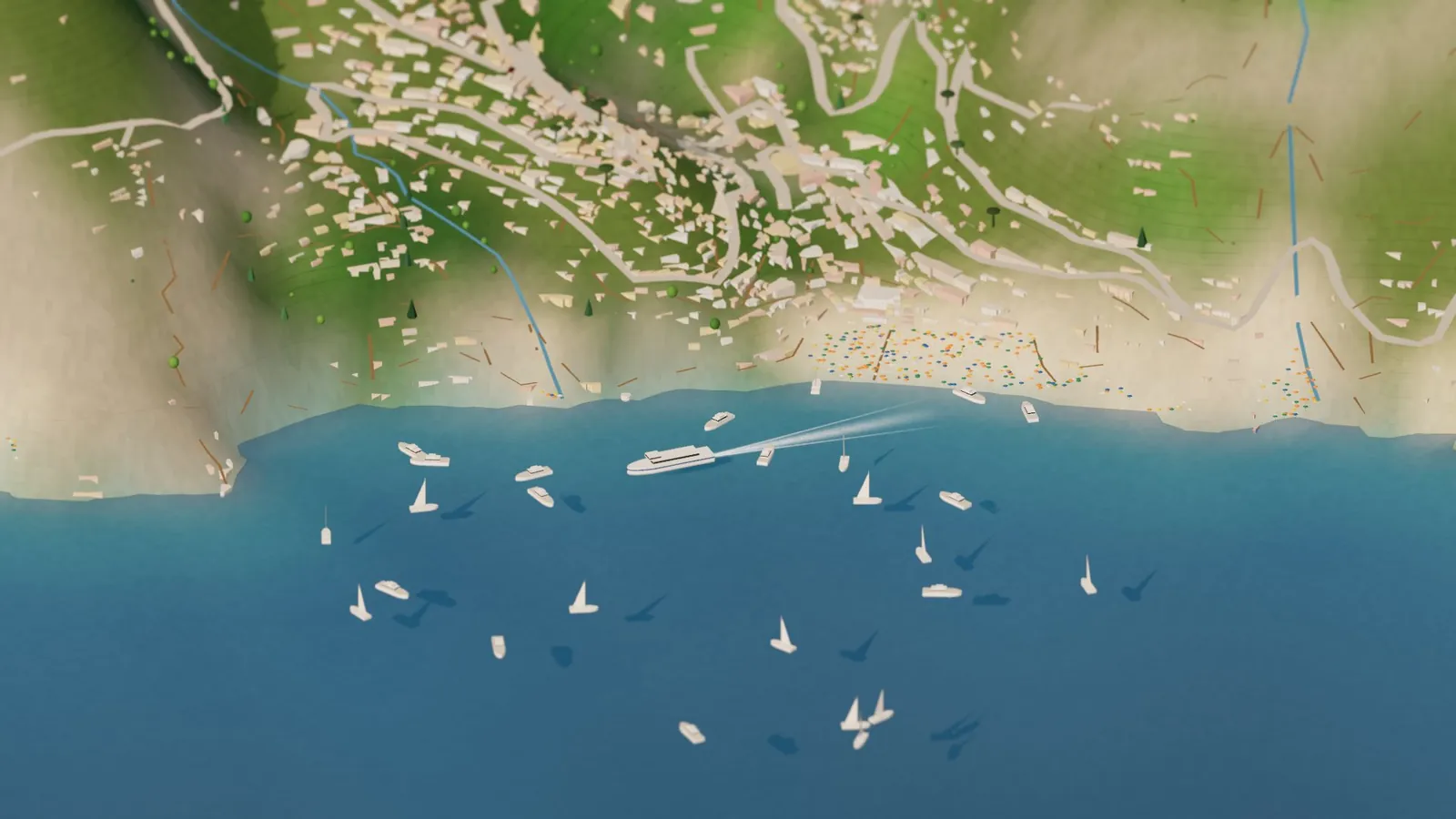
Positano in high summer: the umbrellas, the ferry at the pier and the boats at anchor.
Capri
Capri sits off the end of the peninsula, a limestone island with cliffs all the way around. Two high points hold it up, Monte Solaro above Anacapri in the west and the ridge of Villa Jovis in the east, with the town of Capri in the saddle between. Off its south-east corner stand the Faraglioni, three great rock stacks rising out of the sea. Every ferry in the diorama seems to be heading for Marina Grande.
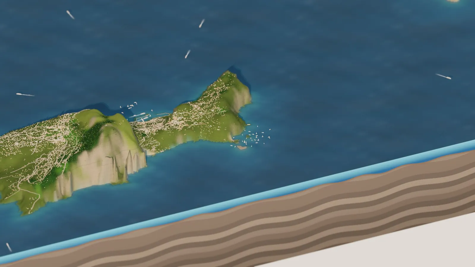
Capri, with Monte Solaro on the left, Villa Jovis on the far ridge, and boats at anchor by the Faraglioni.
Li Galli, the islands of the Sirens
Out in the bay west of Positano are three tiny islands called Li Galli. Legend says they were home to the Sirens, whose songs lured sailors onto the rocks, and Odysseus had himself tied to the mast to sail past them. In more recent times they belonged to dancers: the choreographer Léonide Massine bought the largest one in 1922, and Rudolf Nureyev bought the islands in 1988 and spent his last years there. Today they’re private. You can’t land, but boats anchor around them and people swim in the clear water, just as they do in the diorama.
The Path of the Gods
High above Positano, the Sentiero degli Dei runs along the mountainside from Bomerano, in Agerola, to Nocelle, about 8 kilometers. It’s one of the great walks of Europe, with the whole coast and Capri laid out far below. Italo Calvino described it as a road “suspended over the magical gulf of the Sirens.” In the diorama you can fly to it, then tip the view down and see the coast the way the walkers do.
Lemons on the terraces
Look closely at the slopes and you’ll see they’re striped. The farmers here have been building terraces for nearly a thousand years, stair after stair of dry-stone walls holding up little strips of flat ground on mountainsides that are much too steep to farm otherwise. Many of them grow lemons. In the diorama the orchards and garden terraces get those stripes, rows of small round lemon trees, umbrella pines and scrubby maquis lower down, and chestnut and oak woods up on the mountains.
Amalfi, the old sea power
Amalfi itself is small today, a town of a few thousand people squeezed into one steep valley, with the great striped cathedral of Sant’Andrea at the top of its stairs. But a thousand years ago it was one of the great powers of the Mediterranean.
Ravello, above it all
Ravello is the one I love most. It sits on a ridge about 1,200 feet above Amalfi and Minori, quiet and green, with two famous gardens hanging over the edge. In the diorama it’s at its best in golden light, with the shadows filling the valleys on either side.
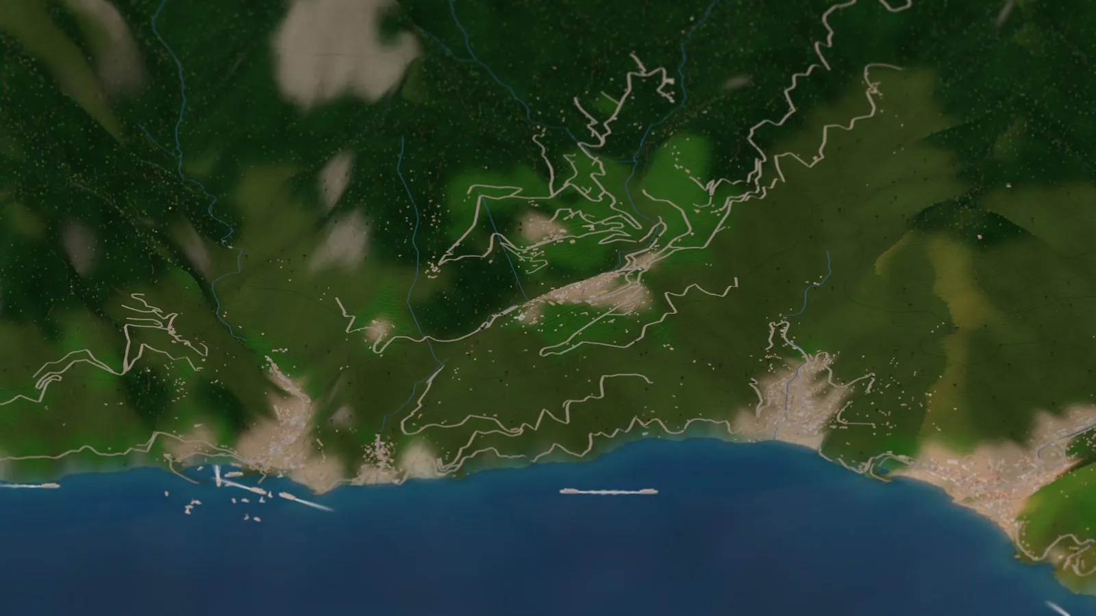
Ravello on its ridge, with Amalfi and Atrani down at the sea on the left and Minori on the right.
Night on the coast
My favorite moment is the end of the day. Slide the clock to Night and the windows light up in Positano, Amalfi and up on the ridge at Ravello, the ferries run lit across the bay, and every boat at anchor shows its little white light on the dark water.
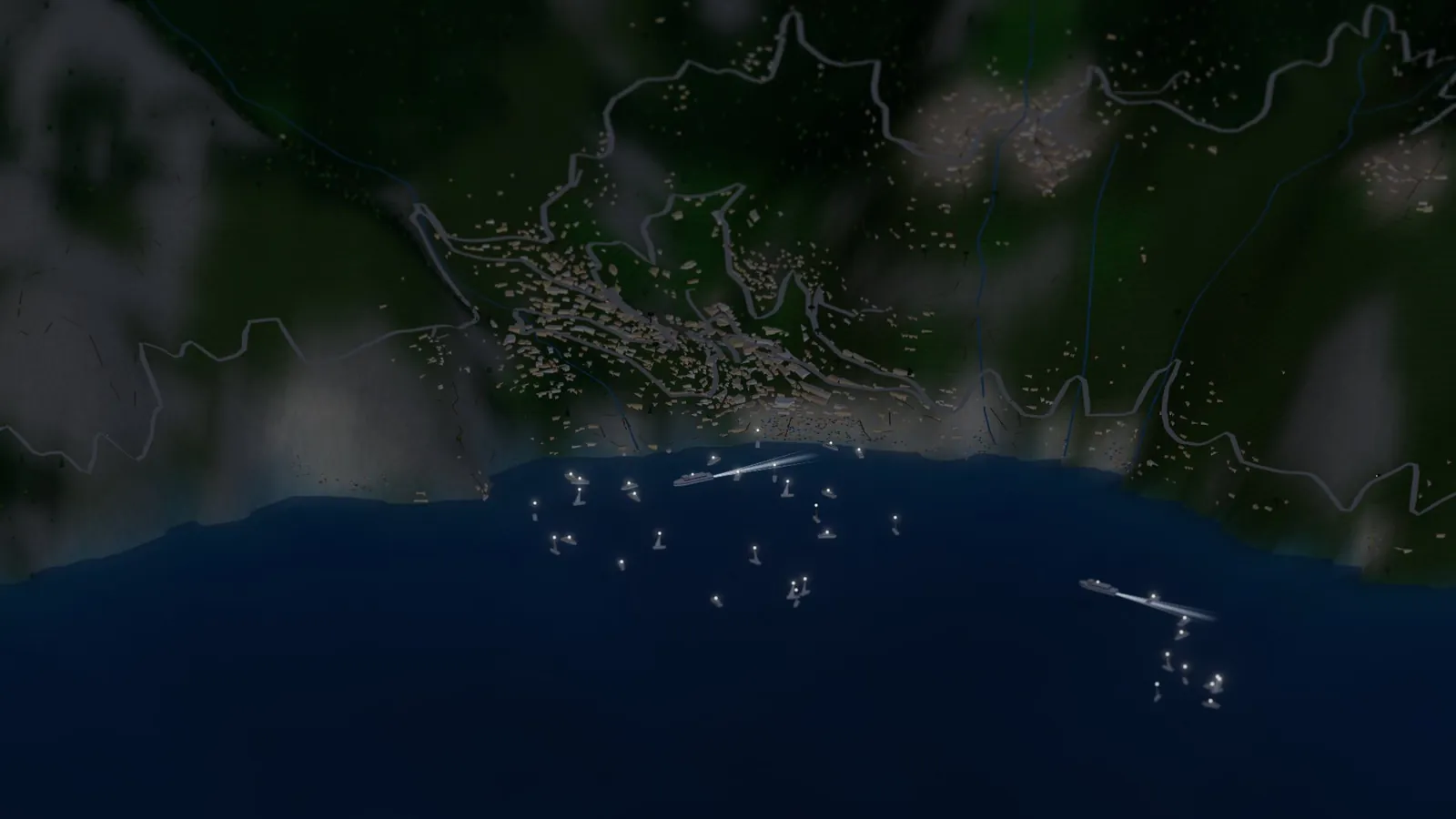
Positano after dark, with anchor lights across the bay.
How it’s made
It’s the same little engine as my Seattle and Yosemite dioramas, with one big new thing in it: the sea. The U.S. Geological Survey data I used for Yosemite stops at the border, so for Italy the land comes from Terrain Tiles on AWS, which stitch together SRTM and EU-DEM elevation, on a 35-meter grid. The coastline comes from OpenStreetMap, and the script uses it to split land from sea cell by cell.
The seabed takes a little make-believe. At this level of detail the elevation tiles are flat at sea level over the water, so I shaped the seabed from each spot’s distance to shore, shelving off steeply the way the real coast does. It looks right, but it isn’t surveyed. The rest comes from OpenStreetMap too: about 45,000 buildings, the roads and paths, the beaches (where the umbrellas go), the orchards (where the lemons go), the ferry lines and the names.
The browser does the drawing in Three.js: the terrain, the layered rock of the slab, the water with its ripples, the boats and their wakes, the cars, and Vesuvius standing on the horizon to the north, with Ischia off to the west. GitHub Actions builds and publishes it all, and the film was rendered there too, split across 20 free computers. As before I built it with Claude: I brought the places and the love for them, and Claude wrote the code. The code is on GitHub.
Go deeper
The live diorama — ride the coast road, take the ferry to Capri, flip the season. Seattle, Yosemite, Tuolumne Meadows and Mono Lake are in the place picker too.
Yosemite in Miniature and Seattle in Miniature — the first two.
Wikipedia: Monti Lattari · Wikipedia (Italian): the SS163 Amalfitana · Discover Campania: the Path of the Gods
Wikipedia: History of Capri · Wikipedia: Blue Grotto · Wikipedia: Il Gallo Lungo (Li Galli)
FAO: The Amalfi lemon and its layered, resilient landscape · Wikipedia: Amalfi · UNESCO: Costiera Amalfitana
Wikipedia: Villa Rufolo · Wikipedia: Villa Cimbrone · Wikipedia: La Rondinaia
Terrain Tiles on AWS — the land (SRTM, EU-DEM). · OpenStreetMap — coastline, buildings, roads, beaches, ferry lines and names, © OpenStreetMap contributors (ODbL). · Three.js · the code.