Milos Popovic shipped forge3d 1.40.1 yesterday, with a new example: a camera flythrough of Bryce Canyon. I wanted to try it right away, and there was only ever one place to point it. I grew up in Groveland, on the road to Yosemite, so it had to be the valley.
The plan: start at Half Dome, drop into the valley, fly it end to end, turn around at Tunnel View, and come back to the classic Half Dome view. On a June evening, because that’s when the granite glows.
Yosemite Valley on a June evening, 7:15 PM · USGS 3DEP lidar (Yosemite National Park, 2019) · USDA NAIP aerial imagery · rendered with forge3d 1.40.1
Half Dome and back
under the camera
on a laptop GPU
1080p render
The flight
- Half Dome. It opens hovering over Tenaya Canyon, facing the sheer north-west face with the low sun full on it, then slides down along the face into the valley.
- Down the valley. About 400 metres off the floor, it flies west past Curry Village, Sentinel Bridge and Yosemite Falls, then between El Capitan and the spires of Cathedral Rocks, then past Bridalveil Fall.
- Tunnel View. It turns over the Merced gorge and comes around on one of the most photographed views in the park: El Cap on the left, Half Dome in the middle, Cathedral Rocks on the right.
- Back to Half Dome. It flies back up the valley and slows to a long-lens hold on Half Dome from near Sentinel Bridge.
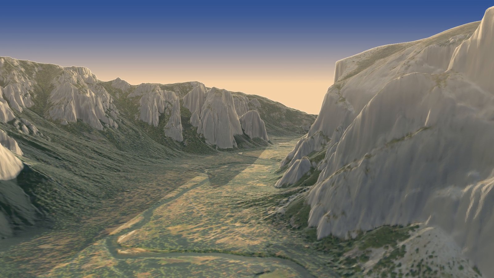
Twenty seconds in: Cathedral Rocks on the left, El Capitan on the right, the Merced below.
How it works: what’s real and what’s painted
It looks like a drone shot, but nothing here was filmed. It’s three layers stacked on a laptop GPU.
- The shape is lidar. In 2019 an aircraft flew over Yosemite firing laser pulses at the ground, hundreds of thousands a second, and timed the echoes. From those the USGS built a bare-earth elevation model at 1-metre detail. I averaged seven of its tiles to a 3-metre grid, about 32 million heights, and forge3d turns that grid into a 3D surface. That’s why El Cap and Half Dome have their real shapes.
- The colour is a photo. NAIP is aerial photography the US flies over the whole country every couple of years. It’s draped over the surface like a tablecloth. The forest you see is a photo of treetops from 1.5 metres a pixel. There are no 3D trees; from 400 metres up you can’t tell.
- The light is computed. For every frame the GPU works out where the sun is (June 20, 7:15 PM, low in the north-west), which way each slope faces it, which ridges throw shadows across the valley, and how much darker the folds and creases should be. Then a few lines of Python paint the evening sky, warm up the highlights and add a little haze toward the horizon.
The camera path is just fifteen keyframes, each a position, a point to look at and a lens, smoothed into one curve. A check against the lidar lifts the camera wherever it would pass within 110 metres of the ground.
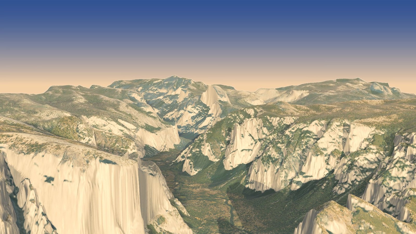
Coming around at Tunnel View, on a longer lens.
Three things that went wrong first
- I flew it into El Capitan. My first path ran a kilometre too far north, right over El Cap’s rim. The clearance check had to lift it 760 metres to avoid hitting the rock. So I traced the low line of the valley floor from the lidar itself and laid the path along that.
- The cliffs were the wrong colour. An aerial photo looks straight down, so a 900-metre wall is only a few pixels wide in it, and NAIP is shot around midday, when Half Dome’s face is in shadow. Draped on the cliffs, the photo came out as dark grey smears. Anything steeper than about 50° now gets a granite tone instead, and the evening sun lights it. That’s the glow you see on Half Dome.
- Half Dome started as a blob. I first opened the video from directly above the summit, which turns one of the most famous rocks in America into a shapeless lump. Moving the camera out over Tenaya Canyon, facing the cut face, fixed it.
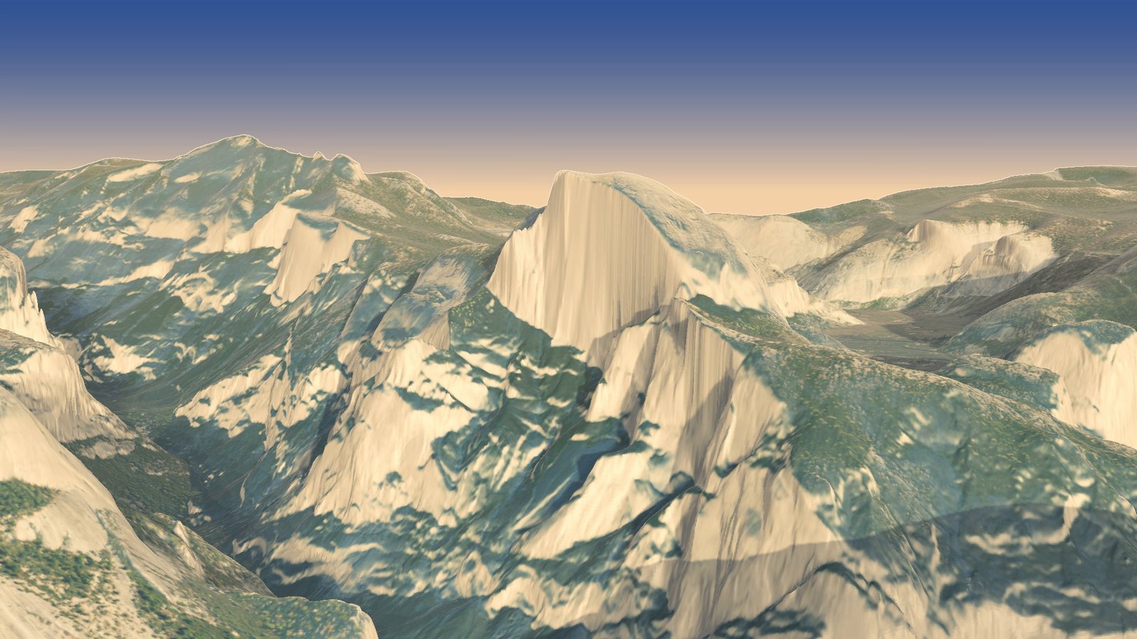
The last frames: Half Dome, with Clouds Rest behind it.
Last thing
Yosemite Valley has been at the end of my road since I was a kid in Groveland. Flying it like this with the newest version of Milos’s tool, from the face of Half Dome all the way down and back, was a real treat. Same tools as the Humphreys Peak orbit and the heat dome, and huge thanks again to Milos for forge3d and for the Bryce Canyon example that started this one.
Data: USGS 3D Elevation Program 1 m lidar DEM, project CA_YosemiteNP_2019, and 1/3 arc-second DEM; USDA NAIP imagery via the USGS National Map. Rendering: forge3d 1.40.1 by Milos Popovic. Sun position from forge3d’s solar calculator.
Go deeper
Yosemite National Park — PlanetGeo: The Geology Podcast, 18 November 2021, about 44 min. Chris and Jesse on the granite, the glaciers, exfoliation joints and rockfall that made the valley.
The History of Granite – Dr. Mike Ackerson — PlanetGeo: The Geology Podcast, 28 March 2024, about 82 min. A Smithsonian curator on how giant bodies of granite like Yosemite’s Tuolumne Intrusive Suite actually form.
Yosemite Nature Notes 4: Half Dome — Yosemite Nature Notes (National Park Service), 14 December 2009, about 10 min video. The park’s own lovely short on the rock at the start and end of the flight.
Yosemite Nature Notes 10: Rock Fall — Yosemite Nature Notes (National Park Service), 7 July 2010, about 9 min video. Park geologists on how rockfall has been reshaping the valley walls since the ice left.
Yosemite Nature Notes 6: Maps — Yosemite Nature Notes (National Park Service), 23 June 2009, about 9 min video. A treat for map folks: Yosemite cartography from Joseph Walker in 1833 to modern GIS.
Collins, B.D. & Stock, G.M. (2016). Rockfall triggering by cyclic thermal stressing of exfoliation fractures. Nature Geoscience 9, 395–400.
Stock, G.M., Collins, B.D., Santaniello, D.J., Zimmer, V.L., Wieczorek, G.F. & Snyder, J.B. (2013). Historical rock falls in Yosemite National Park, California (1857–2011). U.S. Geological Survey Data Series 746. Open access.
Geologic History of the Yosemite Valley — François Matthes, USGS Professional Paper 160, 1930; the classic on how much of the valley is glacier and how much is river, free to read.
The Geologic Story of Yosemite National Park — N. King Huber, USGS Bulletin 1595, 1987; a friendly, well-illustrated tour of the whole park’s rocks.
USGS 3D Elevation Program (3DEP) — the 2019 Yosemite lidar under every frame. · The National Map Downloader — grab the tiles yourself. · NAIP Hub — the USDA aerial photos draped on top.
Yosemite National Park — with pages on the park’s geology and rockfall.
forge3d — the Python terrain renderer. · yosemite-flyover — this project’s code.